Our Alaska 2000 trip report is divided into two parts. Part 1 contains the mountaineering expedition to Denali, and part 2 contains our following trip through Alaska. The same applies to the corresponding "practical hints" pages.
Quick overview - mountains (hikes)
Race Point, Marathon Mountain921 m
Mount Margaret1542 m
Mountain southwest of Marion Creek1036 m
Donnelly Dome1192 m

Alaska: Climb of Denali and travel through Alaska

May 12 - June 11, 2000

Claudia Bäumler and Hartmut Bielefeldt

Part 2: Alaska, May 30 - June 11, 2000


Author of this Text: Hartmut Bielefeldt

Tuesday, May 30, 2000

Anchorage
Preparation day in Anchorage. Since the mountain took much less time than we had expected, we can undertake something else in the next ten days. During the first four days, we want to travel the 200 km distance to Seward by bicycle, do the touristic program there (whale-watching), and return to Anchorage by train.
The remaining six days, we want to rent a car and have a look at the rest of the big country northward. Today we'll try to get all that organized.
The difference between the railroad station of Anchorage and that of a German city of comparable size couldn't be more pronounced: Most trains must be reserved in advance, a change of booking costs $50, and in summer one train daily goes to Fairbanks and one to Seward. No wonder that hardly two customers at the same time are found in the waiting hall.

Wednesday, May 31, 2000

Anchorage - Seward, Part 1 (bicycle)
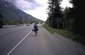
At half past nine we begin our way out of the city heading south. After two hours, slowed down by red lights and several orientation exercises, we reach the sea, i.e. the Turnagain Arm 1, at Chugach State Park Headquarters. We will follow the Turnagain Arm now for 35 miles (56 km) on the Seward Highway which has a considerable amount of traffic. However, the shoulders are always wide enough.
Still hundred miles to Seward

Unlike around Anchorage, the mountains here look much more wintery. Beyond Portage, we have to ascend to Turnagain Pass. Despite its only 300 m height above sea level, there is snow like in mid-winter. Consequently, we cannot see any chance to master the Johnson Pass Trail (450 m a.s.l.) with the bicycles without getting stuck in the snow. What a pity, it might have been a nice variation compared to the road.
So, after 109 kilometers, we spend the night in the Granite Creek campground for an impressive $10, and of course we are the only tent in between all the motorhomes. But the sites are quite far away from each other, so one hardly can see the neighbors through the woods. The campsite is situated nicely at the river.

1 Its name arises from Captain Cooks exploratory mission in 1778. He had to turn back here because of the shallow water. It would have been a dead end anyway (it ends near Portage).

Thursday, June 1, 2000

Anchorage - Seward, Part 2 (bicycle)
Without having met a bear in the night, we continue onour way this morning, chasing up a moose from the edge of the road.
Today we have a lot of ups and downs, with three "passes" (Summit, Moose Pass, and Divide), the highest reaching 430 m a.s.l. Also in between it goes up and down again and again. Between the passes a lot of larger and smaller lakes are scattered about; the mountains are mostly about 1200-1500 m high and still have lots of snow.
After seven hours we reach Seward which is again situated at the sea shore. The Waterfront Campground directly at the sea is relatively cheap ($6 for the tent) and it is not far from "downtown".

Friday, June 2, 2000

Seward
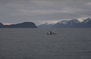
Today we'll do the touristic program, consisting of an eight hour boat trip into Kenai Fjords National Park. This is not too cheap (as many things here in Alaska are), but worthwile. Besides the impressive fjord and island scenery we see a lot of animals: sea otters, eagles, orcas, puffins, humpback whales, seals, mountain goats, kittiwakes (they can tell you their names) and sea lions.
Orcas
Orcas
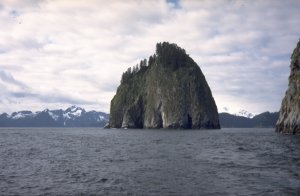
Also this is Alaska
Also this is Alaska

Saturday, June 3, 2000

Seward - Anchorage (train)
Of course we can't miss Marathon Mountain above the "city". Every year on Independence Day, there is a race up the mountain on something that is called a "trail". Only Race Point, 921 m high, can easily be reached, the access to the real Marathon Mountain is difficult due to the narrow crest and lots of snow. But the view is nice anyway, directly down to Seward and the sea. Four weeks before Independence Day many people are training for the competition here.
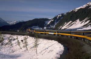
Back to Anchorage by train this evening. The railroad partly follows the highway which we know from our ride southward, but from Moose Pass to Portage the railroad takes its own way through the mountains. Also there we find lots of snow. The train ride takes about four hours for 115 miles.
Traveling back by train.

Sunday, June 4, 2000

Anchorage - Denali NP (car)
We return the bicycles and rent a car in order to drive around Alaska a bit. Today we will drive 250 miles north of Anchorage to the main entrance of Denali National Park. In the visitor center, we get the second last free site at the Riley Creek Campground.

Monday, June 5, 2000

Denali NP
From the end of the public part of the national park road (private vehicles are prohibited west of Savage River bridge) we hike to Mount Margaret. The bushes up to 2 meters high are quite an obstacle. Further up it becomes better - but where we arrive after 1 1/2 hours is definitely not the summit. Another 1 1/2 hours in deep snow are needed to reach the real summit of Mount Margaret, 1542 m. The snow is completely wet and often a lmost bottomless.
Inside Denali National Park, behind the main crest of the Alaska Range, the climate is obviously much less humid than further south. Mountains 1500 m high are heavily glaciated around Seward and Anchorage. While at 600 m altitude on the Kenai peninsula we found a winter scenery, there is no more snow in the campground here at 700 m.
The park is inhabited by a variety of animals. We never met up with any bears during our time in Alaska, but today we met an extraordinarily cheeky squirrel as well as several caribous, a fox up on the mountain and one walking straight through the campground.
The weather is still nice, and has been ever since we flew out from Denali. The climbers on Denali have probably had a good time in the meanwhile. We can see the mountain from the campground Savage River, but it is still 110 km away.

Tuesday, June 6, 2000

Denali NP - Fairbanks - Arctic Circle (car)
From Denali National Park, we drive 100 miles to Fairbanks mainly through woods and hills. Further north towards the Yukon River, the landscape is quite similar to the Black Forest, except of course that it is much less inhabited. Seventy-three miles north of Fairbanks, the Dalton Highway begins, following the Trans Alaska Pipeline as a supply road. Being a "high-speed gravel road", a maximum of 50 mph is allowed. The names on the map are seldom real villages: Yukon (mile 56) consists of a restaurant, a motel, a gas station, and an information counter of the Bureau of Land Management. Arctic Circle (mile 115) is an information sign and some tent sites in a birch wood.
We stay the night there, but there is hardly any night. Small rabbits are hopping around in the birchwoods, and clouds of moskitos are buzzing around, really becoming annoying.
The road follows the pipeline more or less closely.
The pipeline is rather impressive.
The pipeline is rather impressive. The strange objects on top of the posts are cooling devices, preventing the warm oil to thaw the permafrost underneath.
Crossing the arctic circle

Wednesday, June 7, 2000

Arctic Circle - Atigun Pass - Marion Creek (car)
In the morning, a black cloud of these insidious small bloodsuckers is hanging on our tent. Having more or less chased them away, we continue our trip northward through the already quite impressive foothills of Brooks Range. Protected by the mountains, we find more forests in the valleys again, though mostly quite sparse. After a gas stop in the "village" Coldfoot (guess where that name comes from) we reach Atigun Pass (1450 m, mile 245). Alaska's highest highway pass happens to be far in the north, and the scenery looks as if the summer would never arrive here. Beyond the pass, the rivers flow into the Arctic Ocean, and the northernmost spruce tree stood ten miles south of the pass.
My climbing trip to one of the surrounding mountains is thwarted by the very loose but often very steep rock.
At the pass we met a Californian with a bicycle on his way from the North Slope towards Fairbanks.
Having enjoyed the view of the wide wasteland of the north, we turn back at 68°16' n.L. Five miles north of Coldfoot we spend the night at Marion Creek Campground. Here at least the mountains are climbable. The mountains in the north obscure the midnight sun; but it is nice to have sunshine on the way down from the summit at half past ten in the evening.

Thursday, June 8, 2000

Marion Creek - Fairbanks (car)
It's raining in the morning. The rest of the day is quickly told: Back on the Dalton Highway to Fairbanks. What a relief to reach the paved road 30 miles before Fairbanks.
As an exception, we take in a little bit of culture in Fairbanks: the museum of the University of Alaska.

Friday, June 9, 2000

Fairbanks - Glennallen - King Mountain (car)
The weather report yesterday on the radio was typical Alaskan. Instead of "partly cloudy" it rains today, but the moskitos are not impressed by the rain. Chena Lake campground even beats the Arctic Circle in the number of these monsters.
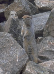
Since we have to fly back home tomorrow, our main goal for today is to travel southward. Nevertheless we can "climb" a prominent hill south of Delta Junction, which we later identified as Donnelly Dome (1192 m). The stone pile on the summit is inhabited by a ground squirrel that intensively examines our ski poles.
The inhabitant of the summit stone pile

Our trip south is via Glennallen along the northern edge of Chugach Mountains, where several impressive glaciers forge ahead to the valleys.
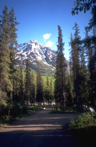
King mountain campground

Saturday, June 10 / Sunday, June 11., 2000

King Mountain - Anchorage (car)
Back to Anchorage. To put it mildly, the airport is confusing. It's strange that it is impossible to post a sign that says the northern terminal is the one for international flights - in a nation which is obviously the world champion in erecting stop signs.
Also the search for stamps for our postcards doesn't begin too successful. The mail office is closed on Saturdays, the first vending machine is in some kind of endless loop, and the machine at the airport behaves like almost every other American vending machine that we got to know: Takes the money, but gives no stamps. As America decided to become a world power, obviously the plumbers and the vending machine manufacturers were absent. Only the use of a more or less violent power of persuasion helps us to our stamps from the machine.
Unlike the flight to Alaska, we reach Frankfurt directly after only nine hours. The night between Saturday and Sunday doesn't exist, due to the route over north pole. The sun remains high in the sky all the time. Back home, we will miss this endless daylight that we experienced in Alaska.
Hartmut Bielefeldt
Sonnhalde 8
D-88699 Frickingen
© 2000 Hartmut Bielefeldt

Valid HTML 4.0! This page is confirmed to comply with the HTML 4.0 standard.
Last updated September 26, 2000 by Hartmut Bielefeldt

Thanks to Stacy Schreiter for kindly checking and correcting my English grammar and spelling.