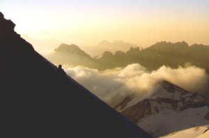
Grand Combin (4314 m)

Traverse: south flank / normal route

Report
September 11-12, 1999

Up to now, the summer of 1999 was rather moderate, considering the 4000 m peaks of the Alps. Our Alpine Club tours worked well, and for the first time we had a success rate of 100% there. But besides that, we couldn't do too many new things. Therefore it is time again to take a try at one out of our wishlist.
We already have had some attempts at Grand Combin, anyway:
This year's action begins with a four-hour ascent to Cabane de Valsorey (3030 m). Besides lots of cattle encountering in opposite direction, many small or bigger re-descents take some time and make the way somewhat bothersome. The trail is rather stony and, for a hut ascent, often quite narrow.
Despite weekend and good weather, there are not many people at Cabane de Valsorey. Unlike in many other hut gastronomy enterprises, here the warden can look after his guests well.
Cabane de Valsorey
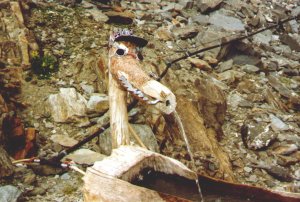
The fountain crocodile (?) of Cabane de Valsorey

On Sunday, we leave at half past four. The weather is not overwhelming, quite foggy. First we follow the normal route of Col du Meitin, after half an hour traversing to the right on the small glacier. Meanwhile, fortunately we are above the fog and can see where we are walking. We follow a trail upwards through the scree, and with increasing steepness through snow and scree to Plateau du Couloir (3660 m). Viewing back downwards from here it is quite clear that a descent on this route would not be optimal.
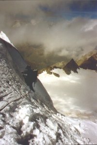
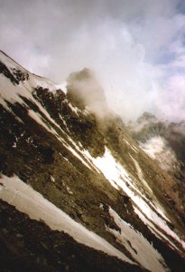
From the plateau on, we follow a less steep scree slope, getting steeper towards its end and finally becoming the south wall. The terrain is about 45° in average steepness and usually very easy, normally I, maybe one or two pitches of a II. But the loose scree lying aroung everywhere makes us climb very careful, especially since four other climbers are ascending beneath us.
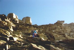
south flank at about 3800m
Morning in the south flank, at about 3800 m
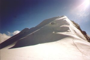
last steps toward Combin de Valsorey
The last steps towards the summit of Gd. Combin de Valsorey
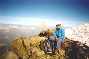
In two hours, the end of this slope is reached at the left side of the steep summit step. As the guidebook indicates a II+ grade, we take the rope which turns out to be unnecessary. The following 80 meters are a nicely trerraced terrain in degree II, almost without any scree - really comfortable. At half past nine we reach the summit of Grand Combin de Valsorey, 4184 m. There is a small cross made of wood.
Grand Combin de Valsorey
Grand Combin de Valsorey (4184 m)

Grand Combin de Grafeneire
Combin de Grafeneire is not far from here.

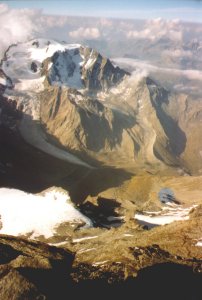
View to Mont Vélan
View far down to Mont Vélan. Cabane de Valsorey is emphasized by a grey circle in the lower right.

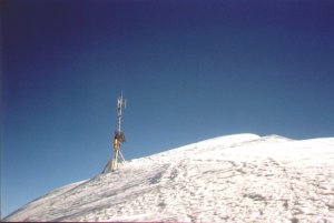
From Grand Combin de Valsorey we descend 50 meters and go up again 180 meters to the main summit, Grand Combin de Grafeneire (4314 m). Instead of a summit cross we are welcomed by a small radio relay station. We enjoy a wide view, which is however limited to the most important things by the ascending clowds: Only the 4000 m peaks peek out of the white cloud masses. Matterhorn, Dent Blanche, Weisshorn, Monte Rosa and in the other direction Gran Paradiso and Mont Blanc.
Grand Combin de Grafeneire
At the end of the 20th century, the summit carries a - radio transmitter (Gd. Combin de Grafeneire, 4314 m)

In order to complete the summits, we had planned to go to Grand Combin de la Tsessette. But the ridge over Aiguille de Croissant looks a bit very sharp, so we try to traverse Mur de la Côte from the side. But that turns out to be impossible (about 60° ice); so we follow the normal route downwards and omit the Tsessette.
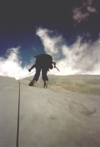
The descent on the normal route also doesn't proceed as we had expected it: A steep ice cliff about 10 meters high can only be overcome by abseil; fortunately there is an ice screw, but the guy who had put this screw could really have chosen a more secure spot. But as things are, reaching the screw securely takes us quite some time. Further down another steep section, and then less steep slopes would come - that's what we expect. But also there slopes are about 35-40°, and there are only some centimeters of snow on the ice. Therefore we have to belay most of it, at least more or less. That takes time, and above us steep seracs are threatening - people say things like that might fall down from time to time. The 600 height meters down to the glacier take about 2 1/2 hours; it is 2 o'clock now.
NNW flank NNW flank
Descent in the NNW flank.

Col du Meitin At Col du Meitin. The narrow snowfield which crosses the image diagonally was our ascent route in the morning.


At three o'clock we reach - now already in the fog of the clouds - Col du Meitin (3611 m). Now we only need to go down to the hut, where we arrive at four.
The warden tells us that one out of the group who descended our ascent route fell down a considerable distance and had to be rescued by the helicopter, heavily injured. Even if it took a long time, it might have been the better decision to descend the normal route.
The rest of the way down to our car takes another two hours.
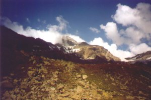
below the hut
Below the hut: Above the steep scree slopes above the hut one can see the south flank


Practical hints

Access to Cabane de Valsorey (3030 m)
Telephone hut: +41 27 787 1122. Usually it is not too crowded, but a reservation is surely advised for larger groups. The hut warden couple is very kind, gives good information and treats everyone (half pension or not) orderly.
From Bourg-St-Pierre one can drive up the road a little more until about 1800 m. From there, following the trail (with some ups and downs which you really will notice on the way back) via Chalet d'Amont (2100 m) to the hut, about 4 hours.
From the hut to Plateau du Couloir and through the south flank to Grand Combin de Valsorey (PD/II)
From the hut, first use the trail to Col du Meitin, i.e. first for some minutes follow the (really obvious) stone marks, then on Glacier du Meitin first upwards, then along the plateau to the right and towards the couloir that comes down from Plateau du Couloir. Parts on trail traces, parts on the snow upwards, becoming steeper in the upper part, and keeping left, to Plateau du Couloir. A little further in the south is Bivacco Musso (10 spaces, but it is said to be quite narrow with only 5 already).
From here, somewhat on the left side upwards to Grand Combin de Valsorey. The terrain is easy, but loose. Some pitches of II, but mostly easy. One ends up on the left side below the summit step, which is then approached in the south flank. The last part is nicely free of loose stuff and pretty easy climbing (II).
Grand Combin de Valsorey - Grand Combin de Grafeneire (F)
Simple glacier walk. 30 to 45 minutes.
How to get down again from Grafeneire ? (PD/AD)
That's a good question. The ascent route is rather critical because of the lots of scree and the considerable steepness of the flank below Plateau du Couloir. Mur de la Côte seems not well suited for descent at the time being, it is very steep (60°). For the descent on the "new normal route", everyone should have an ice screw - possibly one has to leave one there. The rest of the descent down to the glacier is rather steep and is directly below the seracs. I personally don't understand what would be the essential advantage of this route compared to the "Corridor" - both have a high risk of ice avalanches. But the "new normal route" gives a more direct access to the main summit, since after the Corridor one would have to master Mur de la Côte.
From the glacier plateau, one has to cross Col du Meitin to get back to Cabane de Valsorey. It is important not to be misleaded to the right by Col des Maisons Blanches; there is a 150 m ascent to Col du Meitin at the end. From Col du Meitin the trail downwards begins somewhat from the left side, towards Crand Combin. A path leads down to Glacier du Meitin hinunter, where Cabane de Valsorey is easily reached.
My personal opinion meanwhile is that our route was about the best one could choose, at least in summer or fall, at Grand Combin.
Note: Direct descent from Plateau du Couloir to Cabane de Valsorey
In late summer the descent back on our ascent route is very dangerous due to the loose scree and hard ice. On the day of our climb, a mountaineer had a serious accident there, and only some days later a fatal accident occured during descent on this route.

Grades given here correspond to the Swiss/French general grading system.
Maps and guides
Guidebook: Maps:
© 1999 Hartmut Bielefeldt

Valid HTML 4.0! This page is confirmed to comply with the HTML 4.0 standard.
Last updated 09 August 2002 by Hartmut Bielefeldt