Home |
Back to "Mountains" |
Back to "Alps" |
Deutsche Version |
print version (no menus) |
Piz Bernina (4049 m) - Bianco crest (Crast'Alva)
Trip report
July 22-23, 2000
Several years ago, we had to retreat at Fuorcla Prievlusa in October, because the way on was rather icy. This year, that shouldn't be a problem, since there is a lot of snow from spring, and during the last weeks the snow even has increased in the altitude. So we ascend to Tschiervahütte on Saturday in nice weather. The Swiss weather forecast announced stable good weather for tomorrow, around evening some rain and thunderstorms should arrive from the west.
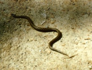 An adder on the way, a little outside Pontresina |
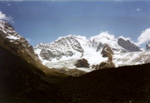 Shortly before Tschiervahütte one can see most of Bianco crest. |
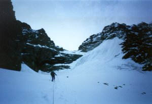 On the way to Fuorcla Prievlusa |
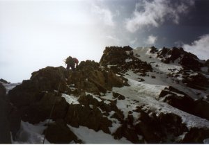
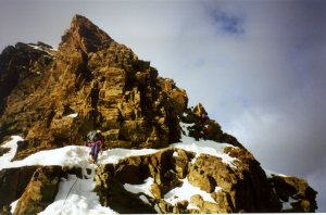 The first pitch of rock above the Fuorcla |
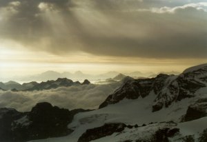 Sunrise takes place between dark cloud layers. |
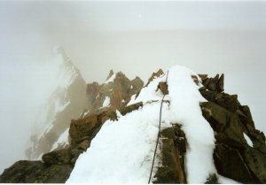
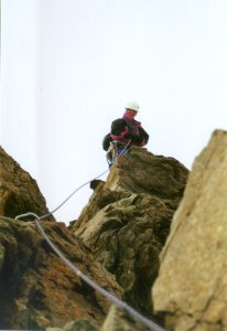 The rock is solid and the route well secured. |
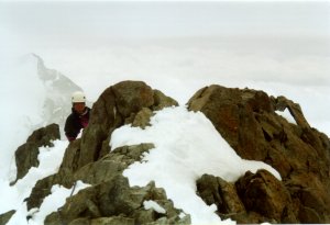
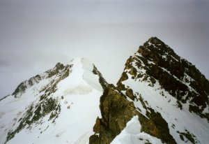 At the end of the rocky pitches |
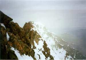
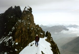 View back, in the background Piz Prievlus. |
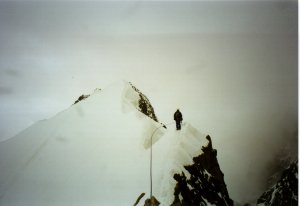
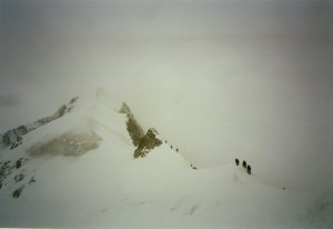 The snow crest begins, conditions are perfect. 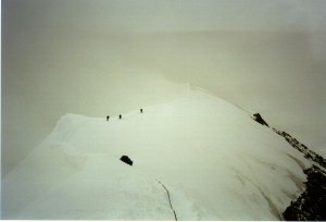 Soon Piz Bianco is reached. |
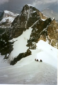 Sometimes we even get a little bit of a view. |
We are on our way since eleven hours now. The storm begins again, and snowfall increases. Should we better stay here and descend to the valley tomorrow? But the weather forecast predicted a real bad weather for tomorrow - and if the trace is hidden under the snow, we'd have no chance to find the way out here over Bellavista terrace if we have no sight. So we decide to fight our way through Bellavista terrace today.
Visibility is just a couple of meters, but fortunately we don't loose the trace. The 200 meters ascent to Bellavista terrace is quite cumbersome, of course. Especially since the "terrace" is not an even plain - we always have to go up and down. Meanwhile the weather turned competely ugly: strong western winds and a wet rain/snow mixture keeps falling down onto us. Everything is wet - a thing that we could well avoid at Mount Mc Kinley. Having encountered no problems on the latter one, would we now suffer frostbite in the Alps? If we only had stayed at Marco e Rosa, until summer would come back again. Everything is so ugly, cold and wet. We can only hope we will find the right trace down to the valley.
Some time we find the turn-off to Fortezza. Finally safe? Not really. The upper part of the Fortezza rocks can be avoided on the left side following a steep snow field, but in the end we come back into the rocks. As usual in such situations, nothing works anymore: With cold fingers, we let the ski poles drop into deep rock slits, the knots don't want to work, and after an abseil, we can't pull off the sh** rope. Of course, all this happens in snow, rain, wind, and you can imagine our enthusiasm now, after 14 hours. But soon it becomes easier. It's all just a question of time, and the snowfall has stopped, too. Six o'clock in the evening, several snowfields, softened and bothersome, and then scree and the Morteratsch glacier.
At half past eight finally the glacier tongue, and at about nine I reach the railway station Morteratsch. Back to civilization again! The timetable, however, is not a surprise: After half past seven, this is a desert. Fortunately, I meet a very helpful tourist couple from Würzburg here. They immediately give me a lift to Pontresina, where I can fetch our car.
Wet as we are, any overnight stay in Engadina wouldn't really make a sense. Astonishingly, after such a day, driving back home is not really problematic, so we are back home at our Lake of Constance at half past midnight. A long, long day. We had not much of a view on the Bianco ridge. Anyway, it's done.
Practical hints
Difficulty
Generally AD, rock III. Details see below.Hut
Chamanna da Tschierva CAS, Tel. 081-8426391. Since 1998 there is a new warden, according to our first impression quite ok. Overnight stay SFr 20/29 (members/nonmembers), a little astonishing the very high price of hot water, Fr. 4.- per liter. Ascent from von Pontresina about 3 1/2 - 4 hours.Ascent to Fuorcla Prievlusa
From Tschiervahütte one follows the trail towards the glacier until the second creek. There is a big stone marker, where the route goes up leftwards following the moraine crest. For orientation at night, some rocks are equipped with reflectors. Further up the trail goes rightward to a long traverse far above the glacier in order to meet a flat glacier area at about 2950 m, above the first crevasse zone. Now left-upwards gaining a steeper step (glacier and rock slabs/scree) to the upper glacier basin. From here, keep on the left edge of the big snow/ice slope on the right side of the small valley. As soon as the rocky barrier allows, one can ascend up to the left to Fuorcla Prievlusa. In late summer the icy slope causes problems, and there is an alternative route meanwhile through the rocks for that case. This part takes about 3-4 hours.The first rock passage
In case of much snow - like during out ascent - one just follows the crest a couple of meters upwards, then traverses an obvious band to upright. Afterwards, the route leads upwards basically a little on the right side of the crest, until shortly before the very highest point a traverse to the snowy slopes at the left is possible. From there the snowy crest is reached. These about 100 meters in the rock are the most difficult part of Bianco crest, with some pitches III. Mostly there are good anchors everywhere. About an hour.Snow crest
The snow crest begins as a very narrow and exposed, horizontal thing. After the traverse of a rocky hillock, it gets broader and steeper. Except for one or two icy pitches (their steepness not justifying a real belay), the ridge was completely snowy and unproblematic. About 1 1/2 hours.Piz Alv - Piz Bernina
From Piz Alv (Pizzo Bianco), the rocky crest leads to the Berninascharte (Bernina gap) quite horizontally. This section is very exposed, but not difficult (I, often hiking terrain). From directly above the gap, abseil down to the gap and better ten meters further down, until the rock tower within the gap can easily be skirted on the right side. In case of less snow, one can also traverse the tower directly - the guidebook considers this to be the safer way. Beyond the tower, one reaches the crest again through a coulois (I-II). Meanwhile not a snow couloir but rather a lot of scree. Therefore, the traverse around the base of the tower is the only pitch that can hardly be belayed correctly. After reaching the crest again, a steep slope which is easier (II) than it looks from the distance, and then a couple of crest hillocks (I) to the main summit. Belay was mostly done using big solid rocks. Time - depending on traffic - probably 1 to 4 hours.Descent via Spedla to Rif. Marco e Rosa
The snow crest is very exposed, and care should be taken especially in the afternoon when wet snow sticks to the crampons. The two rock steps are best overcome by abseil. Easy glacier slopes lead down to Fuorcla Crast'Agüzza. To Rifugio Marco e Rosa, about 2 hours are considered reasonably.Way out over Bellavista Terrace and Fortezza
Without any trace, there would be an abundance of occasions to get lost in the glacier crevasses and seracs. A stay at Marco e Rosa therefore seems only reasonable if good weather can be expected in near future. Without sight and with snow-covered trace there is definitely no chance to find the way via Bellavista Terrace if one hasn't got an extremely good knowledge of the area. Therefore: As long as the trace can still be seen, go and do it (as we did)! After about an hour, we found a junction to the left at about 3700 m, while a less intense trace continuted straight on. The left one is the right one. Further down the trace separated again: A left variant showed mostly descent traces, the right one was clearer. We followed the right one. The left trace would have lead through Loch (la Foura) and would have been much easier. But, in late summer la Foura can be impossible due to open crevasses. Our experiences with the real Fortezza crest are so contradictory to the guidebook to let us state: Whenever you can avoid Fortezza, do it. Try la Foura, if there is a trace.Further down, the terrain soon gets easy. One and a half hours should be calculated from the junction of the glaciers Pers and Morteratsch to the railway station.
The last train to Pontresina leaves at about 19.20.
Remarks
Best time: July. We had perfect conditions: The ascent to Fuorcla Prievlusa still had enough snow, and on the real Bianco ridge the snow seemed even an advantage in the rocky parts, since the snow was very well settled. On the snow crest, there were no problems at all. In June, a lot of snow might be cumbersome in the uppermost portion (Alv-Bernina); later in the year, hard ice is a problem on the snow crest, necessitating belay there.Map and guide
Guidebook:- SAC, "Bündner Alpen 5, Bernina-Gruppe" (in German, 1993), Routes 2 (Tschiervahütte), 215 (Fcla. Prievlusa), 203 (Biancograt), 199 (Spallagrat), 196-198 (Fortezza)
Maps:
- 1:50000 LKS 268S "Julierpass"
- 1:25000 LKS 1277 "Piz Bernina"
P.S.: Many nice weather pictures from Bianco crest can be found at the Academic Alpine Club of Zürich who was there two weeks before:
Home |
Back to "Mountains" |
Back to "Alps" |
Deutsche Version |
© 2000 Hartmut Bielefeldt
![]() This page is confirmed to comply with the HTML 4.0 standard.
This page is confirmed to comply with the HTML 4.0 standard.
Last updated August 09, 2002 by Hartmut Bielefeldt
