| Home |
| Mountains |
| Expeditions |
| Mount Everest 2002 |
| Map |
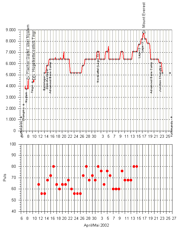
| Height diagram |
| Info |
| Route |
| Climb.History |
| Climb.Statist. |
| Slideshow |
Home |
Back to "Mountains" |
Back to Expeditions |
Trip report Everest 2002 |
Map sketch |
Info |
Route |
Climbing history |
Climbing statistics |
Deutsche Version |
Height Diagram Mount Everest 2002
Home |
Back to "Mountains" |
Back to Expeditions |
Trip report Everest 2002 |
Map sketch |
Info |
Route |
Climbing history |
Climbing statistics |
Deutsche Version |
Hartmut Bielefeldt
Sonnhalde 8
D-88699 Frickingen
Germany
© 2002 Hartmut Bielefeldt
![]() This page is confirmed to comply with the HTML 4.0 standard.
This page is confirmed to comply with the HTML 4.0 standard.
Last updated 17. July 2002 by Hartmut Bielefeldt