| Home |
| Mountains |
| Expeditions |
| Ladakh 2018 |
| Map |
| Height Diagram |
| Info |
| Slideshow |
| This document in the internet: www.bielefeldt.de/ladakh18he.htm |
Home |
Back to "Mountains" |
Back to Expeditions |
Ladakh 2018 |
Map sketch |
Height diagram |
Deutsche Version |
Print version (no menus) |
Ladakh 2018: Lasermo La and Stok Kangri
practical hints
Spelling (supplement)
Since there is no well-defined spelling rule for the Ladakhi characters, one can find different writings which can differ in the vowels (e.g. e/i) as well as in the consonants (b/p, g/k).
- Besides Lasermo La one can also find Lasirmo La (or also Thanglasgo La).
- Tirith is also written Tirit or Tirid.
- Wari La can also be found as Wuri La.
- Shyok River can be Shyog.
- Our guide Norbu also answers to Nurbu.
- We don't know if our assistant's name is written Lopsang or Lobsang.
The trekking routes and mountains, in chronological order
Tirith / Tirith Phu
Although the Nubra valley itself is more or less generally accessible (an Inner Line Permit is needed), as far as I know the same is not true for mountaineering in the adjacent mountain ranges.
There are no expedition permits, one can only undertake some day hikes.
So the beautiful, but not very easy 6000 m peaks in Saser Muztagh (east of Siachen/Nubra River, south of Saser La), Rimo Muztagh (east des Siachen/Nubra River, north of Saser La) and Saltoro Muztagh (west of des Siachen and north of Shyok) are out of reach.
Pretty much the only possibility to reach something like a mountain here is a day hike from Tirith towards Tirith Phu (which is the alp of Tirith). The trail avoids the lower, gorge-like part of the valley and crosses a small pass (3910 m).
The hill west of this pass (3990 m according to GPS) has a gap height of 80 m
From the camp, one follows the road until the bridge crossing the creek coming from the Tirith Phu valley; continue a little further to a steep moraine slope.
A trail leads to the left leading to a decayed building; there, the moraine slope can be climbed using a steep path.
The big rock with the prayer flags can be seen. Behind it, the actual trail to Tirith Phu begins.
Shortly before the pass is reached, on can leave the trail and easily walk to the small summit.
Ladakh Range
The Ladakh Range is one of the northernmost ranges of the Himalayas. It has a very elongated shape and stretches over 350 km from northwest to southeast.
Its borders are Shyok River at the north, Indus River at the west and the south and Pangong Tso in the northeast.
Possibly one can also add the mountain group between Spiti River and the uppermost Indus to the Ladakh Range (there, the Indus would then be the northeast border), then the chain is 700 km long.
Parts of the Ladakh Range are in Pakistan, India (Ladakh) and Tibet. It has a key significance for Ladakh which has its main settlements in the Indus and Shyok (Nubra) Valleys.
In order to get from one to the other, one has to cross the Ladakh Range: The confluence Shyok/Indus is in Pakistan, and the flatter regions of the Changthang are in Tibet.
All passes of the Ladakh Range have an altitude of 5300 m or more. There are several caracan routes crossing the Ladakh Range, out of which some (Khardung La, Wari La, Chang La) have been improved to motorable roads which are kept open year-round because
of the military significance of the region.
In the north beyond Shyok follow the chains of the Karakoram, i.e. the Saltoro Range in the west and Saser Range in the east.
The area beyond Pangong Tso can probably already be counted as part of the Transhimalaya; in these high plains with drainless basins, there are no good criteria to define the mountian ranges orografically well.
Lasermo La / Thanglasgo Valley
The Lasermo La (Lasirmo La, Thanglasgo La) is the nearest pass west of Khardung La. The valleys are oriented in north-south direction, the northern valley are longer than the southern ones. Our trek went from north to south and comprised of 6 day walks:- Hunder (3200 m) - Wachan (3865 m): Since there is the road and the 10 km long gorge looks rather prone to rockfall, one should stay there no longer than necessary, or better go by car.
- Wachan - Tingsa (4280 m): 450 height meters (ascending), 7 kilometers, 3 hours
- Tingsa - Thanglasgo (4660 m): 400 height meters (ascending), 7 kilometers, 3 hours
- Thanglasgo - northern base camp (4990 m): 350 height meters (ascending), 9 kilometers, 4 1/2 hours
- northern base camp - Lasermo La (5470 m) - southern base camp (4920 m): 500 height meters (ascending), 11 kilometers, 4 1/2 hours (3 hours ascent until the pass)
One can also go down one hour further and camp at about 4700 m. - southern base camp - Murabak (4050 m): only descent, 9 kilometers, 3 1/2 hours
A majority of trekkers seems to cross the pass from south to north. This appears disadvantageous for acclimatization, one has to do the whole altitude gain up to 5400 m in only two days.
Unlike in Markha Valley or at Stok Kangri, there is no infrastructure along the trek. There are distinctly less people, we only met one other group per day (mostly 2-3 persons).
Mountains around Thanglasgo Valley
Thanglasgo Valley has several side valleys to the west which were explored by differenz expeditions: In Wachan, Palziampu valley is merging, it leads to the passes Nia La and Nikir La. Near Tingsa, Sniamo Valley merges, having its origin at Yangchen Kangri and Kangsalmathug. From north to south, the mountains gradually become smaller (and easier) while the valley base gains altitude on the way towards Lasermo La. Therefore, the height difference from valley to the summits is 1700 meters near Tingsa, while one has to climb only 700 meters near the northern base camp. The terrain is dominated by loose moraine scree, therefore progress is usually not very fast. Consequently, the mountains in the north demand a high camp.Most mountains in the area have been climbed before, though many of them not very often. Possibly still unclimbed are some peaks in the northeast of Thanglasgo Valley in the area of Lungmochey Kangri.
Samgyal South (6020 m, Olizane Map North) (not visited by us), also referred to as Jungdung Kangri
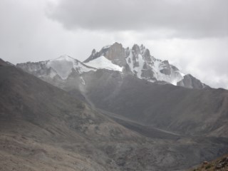 Samgyal South / Jungdung Kangri |
Looks very spectacular. We could not find out where the best access is, nor which of the many rock spires is the main summit.
The northern secondary summit with 5810 m (the small hillock on the left side) was climbed by an expedition in 2008. The main summit was first reached in 2013 by a |
Lungmochey Kangri (6070 m) (not visited by us)
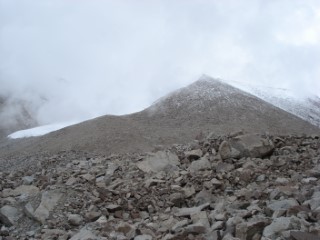 Lungmochey Kangri |
This was the only summit in the chain east of Thanglasgo Valley for which we found a description: There is an article in the |
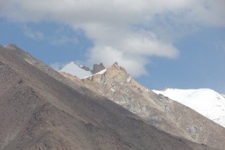 Left side of Lungmochey Kangri |
In the north, Lungmochey Kangri has a neighbor with several summits which possibly is higher. This is a telephoto shot from above Wachan. During our exploration of the area we got no better view than on this picture. Lungmochey Kangri is on the right side. |
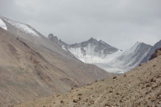 Right side of Lungmochey Kangri |
Towards south, a crest with several buttes follows, leading to a (possibly higher) triangle-shaped summit. Probably this can be reached through the glacier valley and its west ridge. Telephoto from above Wachan. All three mountains require a high camp, from the valley base the height difference is 1400 meters. |
Sahib Chera / Shabib Chasser (6050 m, Olizane Map North) (not visited by us)
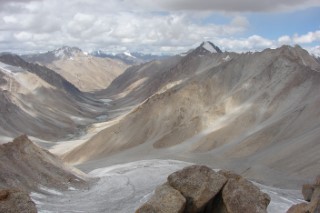 Sahib Chera, seen from Kangsalmathug |
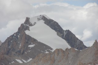 summit region of Sahib Chera |
Striking, impressive 6000 m peak between Thanglasgo and Sniamo Valley. Seems to have rather steep snow flanks in the summit region. Probably it can be climbed from Thanglasgo through a valley southwards and then in a bend towards the north.
However, 1400 meters of altitude difference. The mountain was first climbed in 2007 and is also offered in the |
Kangsalmathug (5770 m, Olizane Map North), also written as Kangsalmathung. GPS: 5784 m
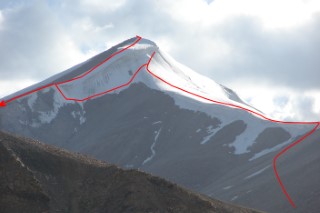 Kangsalmathug (5770) |
One of the few named summits in the southern part.
In literature, we found a description from the north by a We climbed the mountain from the northern Lasermo La base camp through the valley southwest of the muontain. After a tedious scree slope, we had reached the northeast ridge and tried to access the summit from there. But the ridge disappears below the vertical summit cornice, there was no passage to the right. Another way would have been a traverse to the right further down; this seemed not advisable due to the big, partially hidden crevasses there. After a short descent, we could reach the southeast ridge using a short 50° snow slope. Descending from the summit, we continued to follow the southeast ridge to the lowest point on the way to the SE summit. There one can use some very steep scree to go down towards the glacier (the first three meters with extreme caution). Our times: Ascent until below the summit cornice 5 hours, detour to the summit 1 hour, descent 3 1/2 hours. Difficulty rating: PD. Apparently the way using the pass in the southeast ridge is easier than the short, but steep snow slope. Therefore we conclude that quite sure we were the first to use this short direct route. Probably, the above-mentioned climb from south (see above) was done using the whole southeast ridge. |
P. 5275 near northern base camp
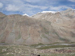 P. 5275 |
A small hill in front of the main range, offering a nice view. A stroll from the base camp, ascent time 1 1/2 to 2 hours. |
P. 5810 (Olizane Map North) east of the northern basecamp
P. 5720 (Olizane Map North) southeast of the northern basecamp (not visited by us)
P. 5605 (own GPS reading; OSM: 5615) east of Lasermo La
P. 5716 (own GPS reading) east of Lasermo La (no height given on the Olizane map)
Zanskar Range
The Zanskar Range is situated southwest of the Ladakh Range. It runs parallel and also has a rather elongated shape. It is more a agglomeration of different mountain groups which have in common a dominant northeast-southwest orientation.
(The Zanskar Range e.g. is completely cut into a nothern and a southern part by the Zanskar River.)
The southern limit is the Suru River which flows from Rangdum past Nun/Kun and enters Shingo River near Kargil, later flowing into Indus River.
To the south, the Chandrabhaga Range and the Pir-Panjal follow; there the Spiti River is the limit between the mountain groups.
During our 2018 trip, we visited only a very small part of the Zanskar Range, namely the Stok Group. It is well defined by the rivers Indus, Zanskar, Markha and the pass Kongmaru La.
South of the Stok Group, the Kang Yatze Group is situated where we had been in 2014.
Stok Kangri (6140 m)
Neighbors of Stok Kangri
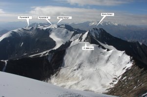 southern neighbors |
In the southeast, Stok Kangri has several neighbors which almost reach the 6000 m line. I have also indicated them on the map, although we did not visit them:
|
Weather
In August 2018, the weather in Ladakh was rather unstable most of the time. On most days there was at least one rain shower or thunderstorm; one day was completely rainy. At Stok Kangri (from August 20 on) there was no more precipitation; this was more like what we were used to from 2014.
Morning low temperatures were around 8 to 10°C. Even at 5700 m altitude we did not have below 4° on the Lasermo La trek.
An exception is the last trekking day where we encountered slight frost in the camp at 4920 m.
At Stok Kangri, the morning temperatures in the camps were around 4° to 10°C. On summit day there was slight frost in the upper part (-1°).
Altitudes
For all places which we visited, I use my own GPS readings (Garmin etrex 30). It indicated a position accuracy of usually about 3 meters. I conclude a height accuracy of better than 10 meters.
Agency in Ladakh
We booked this trip - like also the Ladah trips 2014 and 2015 - with ![]() Gesar Travel as an individually arranged package from/to Delhi international airport.
The crew was very engaged for our well-being. Also changes of the plan were possible on short-term.
Gesar Travel as an individually arranged package from/to Delhi international airport.
The crew was very engaged for our well-being. Also changes of the plan were possible on short-term.
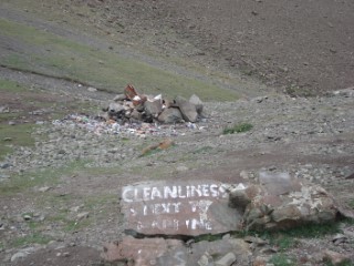
Waste management in the mountains
Literature
- For Nubra Valley and Lasermo La: "Editions Olizane Ladakh & Zanskar 1:150 000 Nord", ISBN 978-2-88086-412-5
- For Leh and Stok Kangri: "Editions Olizane Ladakh & Zanskar 1:150 000 Centre", ISBN 978-2-88086-413-2
Home |
Back to "Mountains" |
Back to Expeditions |
Ladakh 2018 |
Map sketch |
Height diagram |
Deutsche Version |
Print version (no menus) |
Hartmut Bielefeldt
Galleyenstrasse 19/2
D-88048 Friedrichshafen
© 2018 Hartmut Bielefeldt
![]() This page is confirmed to comply with the HTML 4.0 standard.
This page is confirmed to comply with the HTML 4.0 standard.
Last updated November 11, 2018 by Hartmut Bielefeldt
