| Home |
| Mountains |
| Expeditions |
| Kilimanjaro 2004 |
| Map |
| Height diagram |
| Info |
| Slideshow |
Home |
Back to "Mountains" |
Back to Expeditions |
Kilimanjaro 2004 |
Height diagram |
Info |
Deutsche Version |
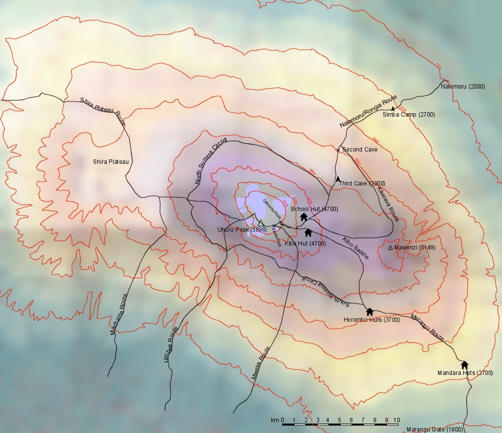
Map sketch of Kilimanjaro

This sketch is based on the map "Kilimanjaro" 1:62500, International Travel Maps, ISBN 189590784-5. The original map is of course more detailed, however the routes on the map are not as precise as in a usual topographic map.
Huts and campsites are included only for the routes which we used, i.e. Nalemoru and Marangu.
Home |
Back to "Mountains" |
Back to Expeditions |
Kilimanjaro 2004 |
Height diagram |
Info |
Deutsche Version |
![]() This page is confirmed to comply with the HTML 4.0 standard.
This page is confirmed to comply with the HTML 4.0 standard.
Last update 25 January 2004 by Hartmut Bielefeldt