| Home |
| Mountains |
| Expeditions |
| Denali 2000 |
| Alaska 2000 |
| Map |
| Height diagram |
| Info Denali |
| Info Alaska |
| Slideshow |
Home |
Back to "Mountains" |
Back to "Expeditions" |
Trip report Denali 2000 |
Trip report Alaska 2000 |
Height diagram |
Info Denali |
Info Alaska |
Deutsche Version |
Map sketch Denali
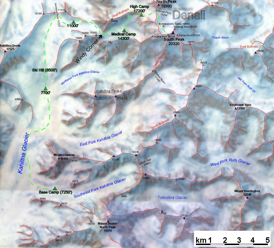
Of course I can only give a general sketch of the area here. It is based on the map "Mt.Mc Kinley 1:50 000" issued by Swiss Federal Institute of Topography and Boston Museum of Science, well known as "the Washburn Map". Like basically every map issued by Swiss Federal Topography, this map combines two aspects in an almost ideal way: being a map and guideline on one hand, and a real piece of art and a plastic representation of the mountains on the other hand. Anyone intending to go to Denali should take it, it is real fun planning for the expedition with this map.
Maps of Alaska on the WWW:
Home |
Back to "Mountains" |
Back to "Expeditions" |
Trip report Denali 2000 |
Trip report Alaska 2000 |
Height diagram |
Info Denali |
Info Alaska |
Deutsche Version |
![]() This page is confirmed to comply with the HTML 4.0 standard.
This page is confirmed to comply with the HTML 4.0 standard.
Last updated August 27, 2002 by Hartmut Bielefeldt